Laurentian Heritage WebMagazine

THE IROQUOIS AND THE SULPICIANS

The signing of La Grande Paix by the Iroquois and the French in Montreal in 1701 brought to an end the wild days of the French-Indian Wars. These wars reflected the European conflicts: the French fought the Iroquois who were allied with the British, while the Huron, Nipissing and Algonquin were either neutral or took the side of the French. As we saw last time, the Weskarinis, who were the indiginous people of our Laurentian area, were casualties of these wars, having been massacred by the Iroquois on the shores of Petit Lac Nominingue in 1751.
Canaux militaires de la rivière des Outaouais

Trois canaux, Carillon, Chute-à-Blondeau et Grenville furent construits sur la rive nord de la rivière des Outaouais entre 1829 et 1833. Contournant les bouillonnants rapides du Long-Sault hauts de 21 km (13 miles), leur conception date des années suivant la Guerre de 1812. À cette époque, on considérait le Saint-Laurent vulnérable et il pouvait devenir la cible d’attaquants venus des États-Unis. Les canaux sur la rivière des Outaouais allaient offrir une voie navigable en direction de Kingston, alternative à celle du fleuve.

THE LAURENTIANS: IN THE BEGINNING

The Laurentians are situated in the Grenville geological province, a slowly moving land mass that collided with the Canadian Shield a billion years ago. It is precambrian. That means that is it was formed before there were any signs of animal life. The cambrian period began with the first signs of animal life only 650,000,000 years ago.

For the entire article, click here: http://www.ballyhoo.ca/history/InTheBeginning.shtml

CHRIST CHURCH, RAWDON

Pioneers trekked on foot and by ox-cart from Berthierville and l’Assomption to the wilderness that would become Rawdon. These people of Scots, English, French, and mostly Irish ancestry arrived as early as 1817. Seen in the foreground is local historian Beverly Copping Prud’homme, a descendant of the Coppings who came in 1819. Beverly fondly remembers her grandfather’s steam-run mill.

AYERS’ WOOLEN MILL, LACHUTE

When American Hezekiah Clark arrived in the area of Lachute on the North River in the 1790s with his family and other pioneers, it was a wilderness. Settled by Americans who had been uncomfortable living with seigneurial law, and Scots moving up the North River from the St. Andrews East area, a village soon developed along the river near the rapids. But it wasn’t until the coming of the railway that the village became an important centre.Image retirée.

Ponts couverts des Laurentides, Partie 1

Au début du 20ème siècle, il existait des centaines de ponts couverts partout au Québec. À la grandeur de la province il n’en subsiste, de nos jours, qu’un peu plus de quatre-vingt-dix, certains datant même des années 1950. Dans les Laurentides, plus particulièrement dans les Hautes-Laurentides, on retrouve six ponts couverts et tous, à l’exception d’un, se situent bien au nord de Mont-Tremblant. Du grand temps des ponts couverts, la plupart des villages en avait un, voire plusieurs.

THE AEROBIC CORRIDOR LINEAR PARK

The Aerobic Corridor (“Corridor Aerobique”) is the Laurentians’ second longest linear park. At nearly 60 km in length, it connects Morin Heights in the south to Saint-Rémi-d'Amherst in the north. Like the 200 km “P’tit Train du Nord” trail, which runs roughly parallel, the Aerobic Corridor follows a former railway line, in this case the CN.

Visite de Saint-André-d'Argenteuil (Saint-André-Est et Carillon)

SAINT-ANDRÉ-EST
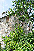
La municipalité de Saint-André-d’Argenteuil, qui inclut les anciens villages de Saint- André-Est et Carillon offre un cadre enchanteur pour une visite d’un jour ou deux. On y découvre tellement d’édifices patrimoniaux, et dans un cadre tellement enchanteur, que les visiteurs n’auront aucune difficulté à trouver des lieux intéressants.Le moulin. (Photo - Matthew Farfan)