Laurentian Heritage WebMagazine

THE IROQUOIS AND THE SULPICIANS

The signing of La Grande Paix by the Iroquois and the French in Montreal in 1701 brought to an end the wild days of the French-Indian Wars. These wars reflected the European conflicts: the French fought the Iroquois who were allied with the British, while the Huron, Nipissing and Algonquin were either neutral or took the side of the French. As we saw last time, the Weskarinis, who were the indiginous people of our Laurentian area, were casualties of these wars, having been massacred by the Iroquois on the shores of Petit Lac Nominingue in 1751.
MILITARY CANALS OF THE OTTAWA RIVER

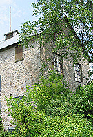
Three canals, the Carillon, Chute-à-Blondeau, and Grenville, were constructed on the north side of the Ottawa River between 1819 and 1833. Bypassing a formidable thirteen mile (21 km) stretch of rapids known as the Long Sault, they were conceived in the years following the War of 1812. At that time, the St. Lawrence was still considered vulnerable to attack from a potentially hostile United States. The canals would make the Ottawa River a navigable alternative to the St. Lawrence as a route to Kingston.

THE LAURENTIANS: IN THE BEGINNING

The Laurentians are situated in the Grenville geological province, a slowly moving land mass that collided with the Canadian Shield a billion years ago. It is precambrian. That means that is it was formed before there were any signs of animal life. The cambrian period began with the first signs of animal life only 650,000,000 years ago.

For the entire article, click here: http://www.ballyhoo.ca/history/InTheBeginning.shtml

CHRIST CHURCH, RAWDON

Pioneers trekked on foot and by ox-cart from Berthierville and l’Assomption to the wilderness that would become Rawdon. These people of Scots, English, French, and mostly Irish ancestry arrived as early as 1817. Seen in the foreground is local historian Beverly Copping Prud’homme, a descendant of the Coppings who came in 1819. Beverly fondly remembers her grandfather’s steam-run mill.

AYERS’ WOOLEN MILL, LACHUTE

When American Hezekiah Clark arrived in the area of Lachute on the North River in the 1790s with his family and other pioneers, it was a wilderness. Settled by Americans who had been uncomfortable living with seigneurial law, and Scots moving up the North River from the St. Andrews East area, a village soon developed along the river near the rapids. But it wasn’t until the coming of the railway that the village became an important centre.Image removed.

COVERED BRIDGES OF THE LAURENTIANS, PART 1

By the beginning of the 20th century, there were hundreds of covered bridges all across Quebec. Today the province numbers just over ninety, some built as late as the 1950s. In the Laurentians, there are six covered bridges, all in the Upper Laurentians, and all except one are well north of Mont Tremblant. In the heyday of the covered bridge, most villages had at least one; some had several. They dotted the back roads as well, crossing brooks and rivers of all sizes. Very few, however, have survived the ravages of time.

THE AEROBIC CORRIDOR LINEAR PARK

The Aerobic Corridor (“Corridor Aerobique”) is the Laurentians’ second longest linear park. At nearly 60 km in length, it connects Morin Heights in the south to Saint-Rémi-d'Amherst in the north. Like the 200 km “P’tit Train du Nord” trail, which runs roughly parallel, the Aerobic Corridor follows a former railway line, in this case the CN.

TOUR OF SAINT-ANDRÉ-D'ARGENTEUIL (ST. ANDREWS EAST & CARILLON)

ST. ANDREWS EAST
The municipality of Saint-André-d’Argenteuil, which includes the former villages of St. Andrews East (Saint- André-Est) and Carillon and the parish of Saint-André-d’Argenteuil, is a wonderful place to spend a day or two. There is so much historic architecture in this area, and amid such a lovely setting, that visitors will have no trouble finding sights to see. Mill.