 The early routes travelled by the Abenaki Indians of the Eastern Townships included the big lakes, like Memphremagog, Champlain, and Massawippi, and rivers, such as the St. Francis and the Missisquoi. The Abenakis used birch bark canoes as well as dugout canoes made from single logs. The interiors of their dugouts were first burned, then carved out with stone adzes.
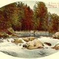
Between their water routes, the Abenakis portaged, carrying their canoes and all of their provisions over land to the next stretch of water. The portage from the Missisquoi River (left) to Lake Memphremagog is thought to have run from near present-day Mansonville to Vale Perkins. Mentioned in early maps and settlers' diaries, the portage is believed to have started about two and a half miles (four kilometres) southeast of Mansonville (near Highwater), continued south of Hawk Mountain, then northeast to Perkins Landing -- a distance of about seven and a half miles (twelve kilometres).
In neighbouring New England, the Abenakis travelled via the Penobscot River in Maine and the Connecticut River in New Hampshire, Massachusetts and New York.