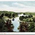
 The major lakes and rivers provided the only way to travel in the Eastern Townships before the area was opened for settlement. The two major lakes were Champlain and Memphremagog. Both stretched on either side of the international border, partly in Canada and partly in the United States.
Lake Champlain:
Lake Champlain and its shores were the scene of warfare between the English and the Indians, then later, the English and the Americans. Some of the first Loyalist settlers came to Missisquoi Bay by Lake Champlain, and more would follow.
Lake Memphremagog:
Lake Memphremagog was first travelled by the Indians in birch bark canoes. The Abenakis named the highest mountain, Owl's Head, after their chief. Travelling by this lake, the first settlers of Brome County, who were led by Nicholas Austin, arrived.
Whenever travel by water was not possible, the Indians and settlers turned to the land. It took longer to travel this way, especially while blazing a trail through the forest on foot. However, settlers also used horses and ox sleds to draw provisions over the developing, but still primitive tracks. Some tracks, used more than others between the growing settlements, eventually became the permanent roads.
Rivers:
The numerous rivers of the Eastern Townships were highways for the early settlers, many of whom arrived by the St. Lawrence. In the Townships, they found, among others, the Pike, Richelieu, Yamaska (north, south, and central branches), Massawippi, Missisquoi, St. Francis, Becancour, and Nicolet Rivers, as well as many other smaller streams and brooks. Not all, however, were navigable, in some cases impeding settlement of the region.